
San Francisco to Sonoma


We touched down in a sunny San Francisco on Tuesday afternoon feeling very fortunate to be setting out on another great holiday in the USA. We overnighted in a hotel close to the airport so that we could pick up our car on Wednesday morning and begin our road trip.

Our Jeep Compass
We hit the road and headed north towards the Golden Gate Bridge which due to the weather was partially covered in mist.


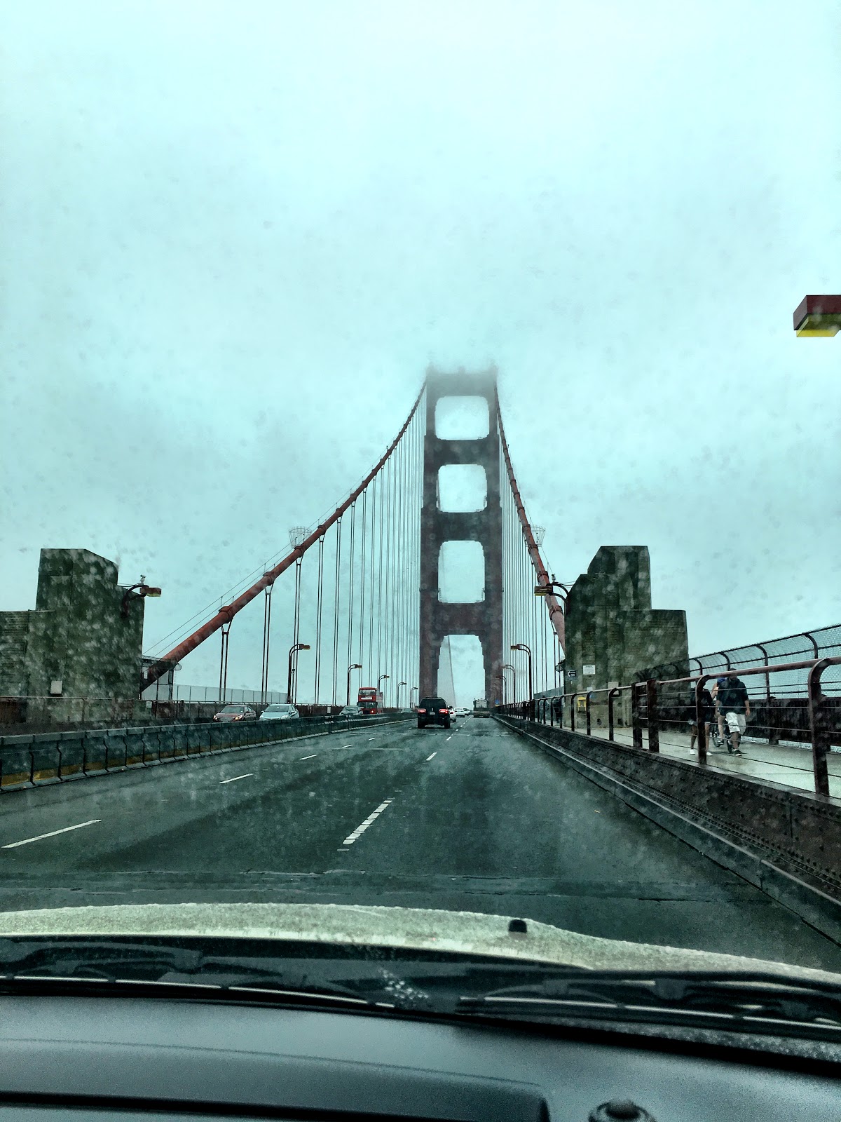
A misty Golden Gate Bridge from our Jeep

MThe weather improved as we left San Francisco and when we reached Sonoma the sun was shining to welcome us. 
The historic picturesque town of Sonoma is home to Sonoma State Historic Park - site of the northernmost Franciscan mission in California and birthplace of the California State Bear Flag. Located in the heart of the beautiful wine country between Napa and Santa Rosa the town surrounds a central plaza (the largest of its kind in California), filled with charming shops and restaurants. The town centre also has many 
historic sites including the Mission San Francisco Solano and the Sonoma Barracks. 
The striking basalt stone City Hall is located in the town plaza in the heart of Sonoma. 


Sonoma City Hall


Sylvia chatting with One of the locals
Our hotel was just one block from the plaza so we were very close to the main sites and some great restaurants including the widely acclaimed Girl and the Fig where we had a 
beautiful meal on the Friday evening. 


The area is filled with wineries and we visited the Bartholomew Park Winery and had a picnic lunch overlooking the acres of vines but sadly our Jeep Compass no to vino so it was healthy fruit and veggie smoothies. 

A Californian picnic


Local vines


We also visited Napa which is much bigger than Sonoma but not as picturesque in our minds. 
We left Sonoma on the Saturday morning and headed to Stockton for an overnight stay before heading to Yosemite. 


Comments

  1. Very informative with great pictures. Looking forward to the next episode.

    ReplyDelete

Post a Comment

Popular posts from this blog

Holbrook, AZ to Peach Springs, AZ

We left Holbrook in bright sunshine and continued our drive along Rte 66 which once again had us driving on the Interstate at times. Our first stop was in Winslow made famous when The Eagles recorded "Take It Easy" whose second verse starts with "Standin' on a corner in Winslow Arizona". We then drove on to Flagstaff but didn't stop in the city. Flagstaff has a beautiful forested location high up on the Colorado Plateau and it was a change to be driving on roads lined with tall ponderosa pine trees. We had a picnic lunch off the beaten track in Buckskinner Park, Williams, AZ. We followed a dirt trail to the picnic area which really tested our car's tyres.  They survived, thankfully. We soon found ourselves in Seligman (pronounced Sligman), a sleepy town which maintains a lot of its historic character together with a few unexpected twists - eg Santa in a Chevvy outside the wacky Snow Cap Drive-in. Our destination for the night was th...

Amarillo, Texas to Tucumcari, New Mexico

We packed up after breakfast and continued our drive through Texas. Our first stop was at a ranch. Usually one expects to see horses at a ranch but this one was home to a row of half-buried Cadillacs! It was the idea of a controversial millionaire, Stanley Marsh from Amarillo. He said he created it as tribute to the golden age of car travel!! Visitors are encouraged to leave their mark by spray painting their names, comments etc. on the cars. We soon reached Vega, another small town with lots of Rte 66 treasures including a restored 1920s Magnolia gas station and the Milburn-Price Museum in what was previously the town bus station. Miss Karen, the owner told us lots of interesting stories about the museum pieces which were all donated by local families. Outside the museum there was a beautifully restored 1923 Model T Ford. We reached Adrian, TX which marks the mid point of the Route - 1139 miles east to Chicago and 1139 miles to Santa Monica, Los Angel...

Peach Springs,AZ to Las Vegas, NV

It was dull and overcast when we got up this morning and the weather got worse as time went on. It rained quite heavily as we drove north towards the Hoover Dam. We later discovered that there was a number of weather alerts for flash floods issued for the area we were driving through that morning. The Hoover Dam is located between Arizona and Nevada on the Colorado River. Lake Mead, which formed behind the dam is the largest man-made reservoir in the Western Hemisphere. We accessed the Dam by driving over the O'Callaghan-Tillman Bridge ( see photo below) whose total length is 1905 feet, making it the longest single-arch bridge in North America. At 880 feet over the Colorado River it is the 2nd highest bridge in the USA and the highest concrete-arch bridge anywhere. During the Depression in the 1930s, thousands of men and their families came to Black Canyon to build the Hoover Dam and tame the Colorado River. It took them less than 5 years in this harsh and barre...