
Santa Barbara and Laguna Beach, CA


We left Solvang on Tuesday morning after breakfast for the short drive to Santa Barbara. Once again it was a scorcher of a day, with temperatures near the one hundred mark! We drove down to the coast and stopped at the beach in Goleta.
We reached Santa Barbara in time for lunch. Santa B is often described as the Californian Riviera. 
Many of the buildings are whitewashed with Spanish red-tiled roofs and its main street, State Street, leads down to a beautiful beach. 

Santa Barbara Courthouse 
View from Courthouse tower


The harbour and wharf areas have some great fish restaurants and we enjoyed some lovely meals there. 

We rented bicycles and biked along the coast early on Thursday morning before the temperature got too high. 


While walking in the harbour later in the day, we were very lucky to see a school of dolphins swimming close by. 
We also saw many of the brown pelicans for which Santa Barbara is 
famous. 


Friday morning saw us start our drive along the coast to Laguna Beach, our final destination on this trip. For a number of miles, a heavy marine layer fog came in from the coast and partially covered the highway. 


We stopped at Malibu beach where there are some amazing beach houses.

How the other half live!


After a break for lunch in Santa Monica we drove south through Los Angeles to get back on the Pacific Coast Highway and continue our journey to Laguna Beach.

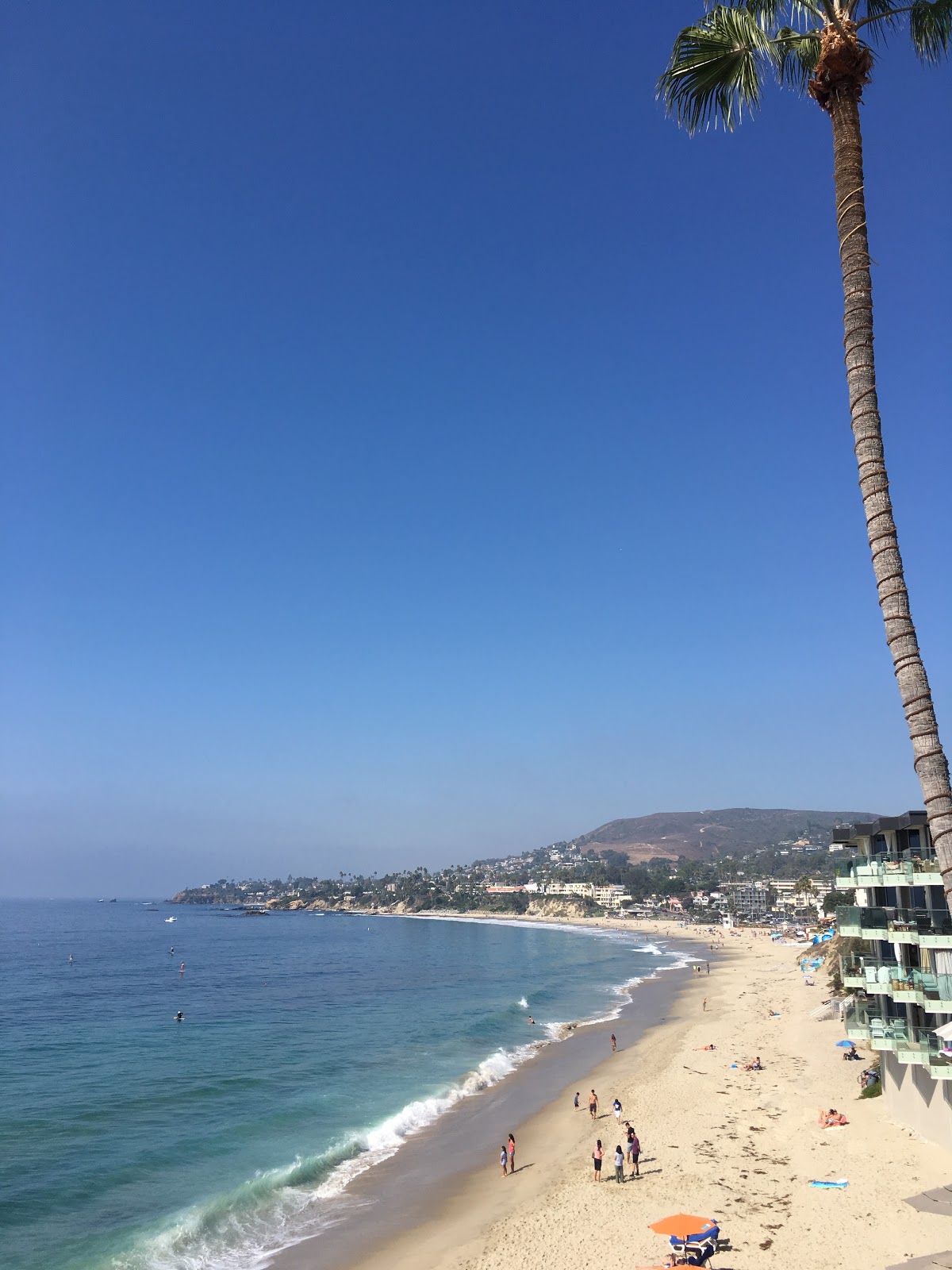
We are very lucky to be staying right on the beach with the sound of the waves breaking on the sand just below our balcony


Unfortunately the weather changed and we didn’t see the beautiful red sunsets for which this part of California is famous. However on our last evening we did have a lovely view from our hotel. 


This has been a wonderful trip and thank you for reading our blog.

Comments

  1. Great photos ladies. Back to the good old Irish weather now. Enough time to get ready for the next trip.

    ReplyDelete

Post a Comment

Popular posts from this blog

Holbrook, AZ to Peach Springs, AZ

We left Holbrook in bright sunshine and continued our drive along Rte 66 which once again had us driving on the Interstate at times. Our first stop was in Winslow made famous when The Eagles recorded "Take It Easy" whose second verse starts with "Standin' on a corner in Winslow Arizona". We then drove on to Flagstaff but didn't stop in the city. Flagstaff has a beautiful forested location high up on the Colorado Plateau and it was a change to be driving on roads lined with tall ponderosa pine trees. We had a picnic lunch off the beaten track in Buckskinner Park, Williams, AZ. We followed a dirt trail to the picnic area which really tested our car's tyres.  They survived, thankfully. We soon found ourselves in Seligman (pronounced Sligman), a sleepy town which maintains a lot of its historic character together with a few unexpected twists - eg Santa in a Chevvy outside the wacky Snow Cap Drive-in. Our destination for the night was th...

Amarillo, Texas to Tucumcari, New Mexico

We packed up after breakfast and continued our drive through Texas. Our first stop was at a ranch. Usually one expects to see horses at a ranch but this one was home to a row of half-buried Cadillacs! It was the idea of a controversial millionaire, Stanley Marsh from Amarillo. He said he created it as tribute to the golden age of car travel!! Visitors are encouraged to leave their mark by spray painting their names, comments etc. on the cars. We soon reached Vega, another small town with lots of Rte 66 treasures including a restored 1920s Magnolia gas station and the Milburn-Price Museum in what was previously the town bus station. Miss Karen, the owner told us lots of interesting stories about the museum pieces which were all donated by local families. Outside the museum there was a beautifully restored 1923 Model T Ford. We reached Adrian, TX which marks the mid point of the Route - 1139 miles east to Chicago and 1139 miles to Santa Monica, Los Angel...

Peach Springs,AZ to Las Vegas, NV

It was dull and overcast when we got up this morning and the weather got worse as time went on. It rained quite heavily as we drove north towards the Hoover Dam. We later discovered that there was a number of weather alerts for flash floods issued for the area we were driving through that morning. The Hoover Dam is located between Arizona and Nevada on the Colorado River. Lake Mead, which formed behind the dam is the largest man-made reservoir in the Western Hemisphere. We accessed the Dam by driving over the O'Callaghan-Tillman Bridge ( see photo below) whose total length is 1905 feet, making it the longest single-arch bridge in North America. At 880 feet over the Colorado River it is the 2nd highest bridge in the USA and the highest concrete-arch bridge anywhere. During the Depression in the 1930s, thousands of men and their families came to Black Canyon to build the Hoover Dam and tame the Colorado River. It took them less than 5 years in this harsh and barre...