
Paso Robles to Carmel, CA


The old ranching town of Paso Robles, situated in the Santa Ynez Valley is surrounded by over 200 wineries in the rolling hills around the town.


We drove to the small town of San Miguel to visit the Mission which was founded in 1797.


It was rocked by an earthquake in 2003 but has been restored. However the inside of the church was never repainted and the original artwork can still be seen.


On our way back from the Mission we spotted a pumpkin patch among the wineries. Pumpkins are to be seen in all the towns - as decorations and on menus in some form or other. 


The drive through the hills around Paso Robles was beautiful and it was lovely to have lunch outdoors surrounded by fields of vines.


We spent two nights in Paso Robles and then it was time to move on. We headed west and back to the Pacific Coast Highway. Visibility deteriorated so it took us longer to reach the coast. 

View from car. 

Our first stop was in the quaint town on Cambria. Everywhere we looked there were scarecrows and the town had a real "Hallowe'en" feel to it. 


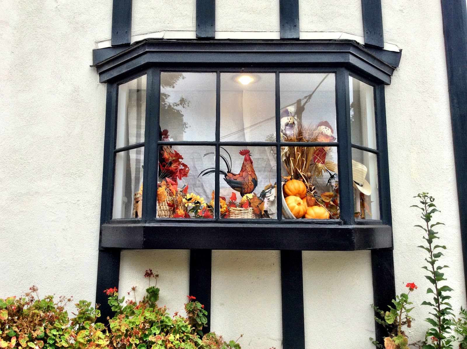
Hallowe'en window in Cambria.

We got back on Highway 1 and continued our drive to Big Sur. As we progressed north the views got more amazing and it is a stretch of road that has to be driven to be believed. The photos below give a hint of what the scenery was like. 


We arrived in Carmel on the Monterey peninsula in the early evening after what was an amazing drive along the Pacific Coast.


Comments

  1. This is just breathtakingly beautiful! I know from some of our own that the heat has been really high in California this autumn. It's probably a little cooler along by the sea but gosh it looks great!

    ReplyDelete

Post a Comment

Popular posts from this blog

Holbrook, AZ to Peach Springs, AZ

We left Holbrook in bright sunshine and continued our drive along Rte 66 which once again had us driving on the Interstate at times. Our first stop was in Winslow made famous when The Eagles recorded "Take It Easy" whose second verse starts with "Standin' on a corner in Winslow Arizona". We then drove on to Flagstaff but didn't stop in the city. Flagstaff has a beautiful forested location high up on the Colorado Plateau and it was a change to be driving on roads lined with tall ponderosa pine trees. We had a picnic lunch off the beaten track in Buckskinner Park, Williams, AZ. We followed a dirt trail to the picnic area which really tested our car's tyres.  They survived, thankfully. We soon found ourselves in Seligman (pronounced Sligman), a sleepy town which maintains a lot of its historic character together with a few unexpected twists - eg Santa in a Chevvy outside the wacky Snow Cap Drive-in. Our destination for the night was th...

Amarillo, Texas to Tucumcari, New Mexico

We packed up after breakfast and continued our drive through Texas. Our first stop was at a ranch. Usually one expects to see horses at a ranch but this one was home to a row of half-buried Cadillacs! It was the idea of a controversial millionaire, Stanley Marsh from Amarillo. He said he created it as tribute to the golden age of car travel!! Visitors are encouraged to leave their mark by spray painting their names, comments etc. on the cars. We soon reached Vega, another small town with lots of Rte 66 treasures including a restored 1920s Magnolia gas station and the Milburn-Price Museum in what was previously the town bus station. Miss Karen, the owner told us lots of interesting stories about the museum pieces which were all donated by local families. Outside the museum there was a beautifully restored 1923 Model T Ford. We reached Adrian, TX which marks the mid point of the Route - 1139 miles east to Chicago and 1139 miles to Santa Monica, Los Angel...

Peach Springs,AZ to Las Vegas, NV

It was dull and overcast when we got up this morning and the weather got worse as time went on. It rained quite heavily as we drove north towards the Hoover Dam. We later discovered that there was a number of weather alerts for flash floods issued for the area we were driving through that morning. The Hoover Dam is located between Arizona and Nevada on the Colorado River. Lake Mead, which formed behind the dam is the largest man-made reservoir in the Western Hemisphere. We accessed the Dam by driving over the O'Callaghan-Tillman Bridge ( see photo below) whose total length is 1905 feet, making it the longest single-arch bridge in North America. At 880 feet over the Colorado River it is the 2nd highest bridge in the USA and the highest concrete-arch bridge anywhere. During the Depression in the 1930s, thousands of men and their families came to Black Canyon to build the Hoover Dam and tame the Colorado River. It took them less than 5 years in this harsh and barre...